
Flood Risk Persists Across the Four Corners After Days of Intense Rain
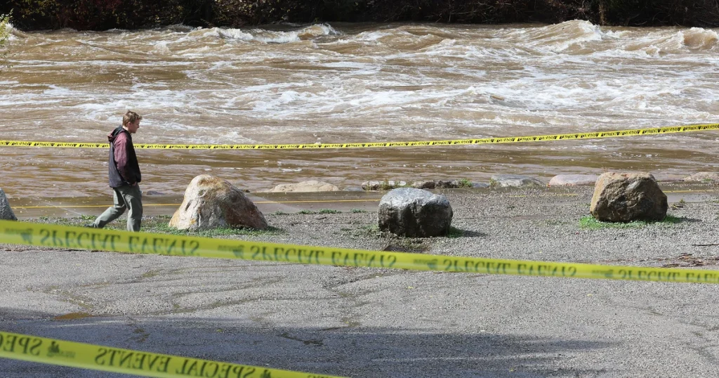
Wertynews.com – Communities across the Four Corners region entered Sunday facing renewed flood concerns after several days of powerful rainstorms caused evacuations, water rescues and damage in parts of the Southwest. The weather threat remained active even as some rivers and floodwaters began to fall from their recent highs.
A flood watch covered much of the area where Arizona, Colorado, New Mexico and Utah meet. The alert reflected the possibility that additional heavy showers and thunderstorms could quickly worsen conditions in places already saturated by repeated rainfall.
The concern is especially significant for roads, small waterways, narrow canyons and areas scarred by previous fires. Intense rain can collect rapidly in these locations, turning normally dry channels into fast-moving flood zones and making travel dangerous with little warning.
San Juan River Levels Rise
In Colorado, water levels on the San Juan River rose sharply overnight. The San Juan River Bridge remained closed Sunday as officials monitored the flow and its effects on nearby infrastructure.
Flooding also reached homes in Pagosa Springs. Footage from the community showed one house nearly submerged, with only part of its roof and chimney visible above the water.
Pagosa Springs resident Chris Mott described the force of floodwater moving through a neighborhood and the limits of protective measures used by residents.
“I’m sorry, buddy. I tried. I really tried. But this one was bigger than the last one. It moved sandbags and everything.”
The scene illustrates how quickly severe rainfall can overwhelm local defenses. Sandbags may help redirect or slow shallow water in some situations, but they can be displaced when runoff becomes deeper or faster than anticipated.
Cleanup Begins in New Mexico
In San Juan County, New Mexico, Sheriff Shane Ferrari said about 4 feet of water flooded his own home. While he described conditions in the county as stable on Sunday, residents still faced the immediate work of cleaning debris, assessing property damage and recovering from the storm.
Officials had not released a confirmed count of damaged homes or evacuated residents. No deaths had been identified as of Sunday, but the disaster response remained ongoing.
As water levels receded, they left behind mud and silt across affected locations. Some of that material was contaminated with sewage following failures at waste plants, creating an additional concern for residents returning to flooded properties. Multiple areas also continued to experience power outages, with restoration expected to take several days in some places.
“It’s a pretty active disaster zone. We’re not on the downswing by any means.”
That assessment underscores the difference between receding water and full recovery. Lower river levels can reduce the immediate flood threat in certain communities, but damaged roads, disrupted utility service, contaminated sediment and unstable weather can keep conditions hazardous well after the heaviest rain has passed.
More Storms Could Shift East
The latest round of rain was expected to remain focused on the Southwest before expanding into the central and northern Plains on Sunday night. The weather system was then forecast to move toward the Upper Midwest on Monday and Tuesday.
For residents of the Four Corners region, the main risk remained repeated thunderstorms capable of producing heavy rain over the same locations. When storms repeatedly cross ground that has already absorbed substantial moisture, runoff can develop more quickly and streams can rise with little time for preparation.
The region’s landscape can intensify the danger. Canyons, dry washes and low-lying roadways may appear manageable until upstream rainfall sends water through them. Burn scars can also be vulnerable because vegetation that would normally slow runoff may no longer be present.
A Wet Pattern After Drought
The flooding follows roughly two months of intermittent heavy rain tied to tropical moisture arriving from the Pacific. The wet pattern came after a prolonged period of drought in parts of the region, a contrast that can leave communities dealing with both water shortages and sudden destructive runoff within a relatively short period.
Recent flooding elsewhere in the Southwest has also been deadly, including events affecting the Grand Canyon and areas of New Mexico. The latest storms add to a season in which residents, emergency workers and local agencies have had to remain alert for rapidly changing weather conditions.
Even where skies temporarily clear, flood impacts can continue. People near rivers, streams, burn scars and recently flooded roads may face lingering hazards from weakened ground, debris, contaminated water and damaged utilities. Local closures and emergency guidance can change as weather forecasts and river conditions evolve.
With another period of thunderstorms possible, the Four Corners region remains in a recovery phase that could be interrupted by more rain. For now, the combination of swollen waterways, damaged infrastructure and unstable weather means the danger has not yet passed.
Related Reading
Frequently Asked Questions
What is Four Corners region faces more flood?
Four Corners region faces more flood is the main topic of this guide. The article explains the context, practical details, and next steps readers should understand.
Why does Four Corners region faces more flood matter?
Four Corners region faces more flood matters because readers are looking for a useful answer, not just a short summary. Good content should match search intent and help them decide what to do next.